A Tour de France stage as a cartoon
A stage profile tells you where the climbs are. A fly-through shows you what they look like: the long drag up the valley, the hairpins near the top, how far it is down the other side. ToonRoute makes one from the stage's GPX file, as a cartoon of the real mountains.
Below is stage 6 of the 2026 Tour de France, Pau to Gavarnie-Gèdre: 186 km and 4,092 m of climbing over the Col d'Aspin and the Col du Tourmalet. It was made from the stage GPX with the Auto camera and nothing set by hand, then cut down to 28 seconds of highlights.
What the video shows
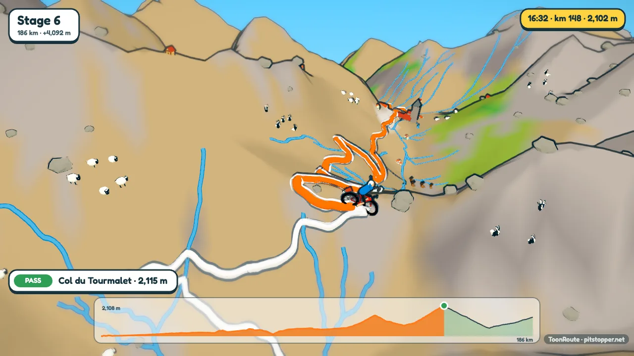
The world is built from the real terrain and map along the route, so the valleys, towns and passes are where they are on the day. Lourdes gets a caption as the rider goes through, and the stage's cols get theirs at the top: Col d'Aspin, 1,489 m; Col du Tourmalet, 2,115 m.
Each climb gets a banner as the rider reaches it, with its length, average gradient and height gained. About 1,200 known climbs are on ToonRoute's list, and a climb on the list is named on its banner: on stage 6 that reads Col d'Aspin, 12 km at 6%, +783 m. The elevation chart along the bottom fills in as the stage goes on.
The camera on a mountain stage
On Auto, the camera reads the whole route before it starts. It films climbs from the side, where you can see the slope, and goes up high over the twisty sections. It also picks a few moments for a shot of their own. On a mountain stage that is usually the top of the biggest climb: the ride slows, the camera rises off the rider's back and circles the summit once, so you see the view all round, then drops in behind again.
Want the camera somewhere else? Choose Video editor in Video. The stage becomes a strip of clips starting from the shots Auto would have used, and you change only the ones you want: a side-on shot on the last kilometre, a drone shot over a descent.
Step by step
- Get the stage as GPX or FIT, or draw it in Create a route.
- Open ToonRoute and choose Use my route file. A 186 km stage is a big area, so the world takes a while to build.
- Set the hills. They are drawn twice their real height to begin with, because true height looks flat from above. In the Alps and the Pyrenees, True to life is plenty.
- Pick the kit colours in Character, and set Average km/h if you want the clock nearer race speed.
- Set a title such as Stage 6: Pau - Gavarnie, then make the video at 720p, 1080p or 4K, wide or tall.
Tips
- On Auto a 186 km stage rides in about five minutes. For a preview to post before the stage, pick a set length of 1 or 1½ minutes in Video.
- The 9:16 shape is made for phones, and the banners and chart are laid out again for it rather than squashed. More on tall videos.
- Save the stage as a project before you close the tab, so you do not wait for the world to build again.
The Tour de France is a trademark of its organisers. ToonRoute is not connected with the race or endorsed by it, and uses no official marks or logos.
Questions
Where do I get the stage GPX?
GPX files of the stages appear on route-planning and fan sites once the route is announced. If you cannot find one, draw the stage in Create a route with Go by set to Cyclist (road), adding the towns and cols as stops so the route goes through them.
Can I show the riders racing?
No. There is one character, riding the route, and nothing about the race itself: no other riders, no team cars, no results.
Why does the clock show 9 hours?
The cyclist goes at 20 km/h on average to begin with, slower up the climbs. Set Average km/h in Character to 40 or so for something nearer a race pace; the video is the same length either way.
Is this an official Tour de France video?
No. ToonRoute is not connected with the Tour de France or its organisers. You make a video of a route that the stage happens to follow.
Is it free?
During the beta, yes: one at a time and up to six a day, at any size. After the beta a video will cost a small amount. The pricing page has the details.
Use my route file Create a route
Other guides
- Turn a GPX file into a video
- A fly-through of your bike ride
- A video of your hike or walk
- A running route video
- Tall videos for Reels and TikTok
- A flight path animation
- A route video for your event
- A cartoon video of your road trip
- A fly-through of a famous climb
- From a Strava activity to a video
- ToonRoute and Relive compared
- Everything ToonRoute does