A flight path animation
ToonRoute was made for rides and walks, but it has a plane, a helicopter and a drone, and they fly. Load the GPX track of a flight and one of them flies your line over a cartoon model of the country underneath, from take-off to landing.
That is the flight over Corsica from the front page: Calvi to Ajaccio, 103 km, past Monte Cinto at 2,706 m.
No track? Draw the flight
You do not need a flight log at all. Create a route, set Go by to the plane, helicopter or drone, and click the map where you took off, where you landed, and anything you flew over on the way: an island, a summit, a lake. You can search for a place by name instead of clicking. ToonRoute flies one smooth curve through your points, swinging wide where it turns, and builds the cartoon country underneath.
A drawn flight has no logged heights, so the video leaves out the elevation chart and the height readout. Everything else is the same.
What it does, and what it does not
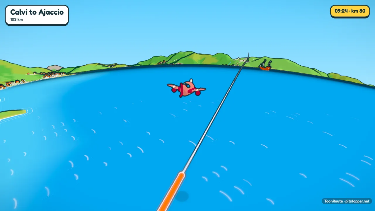
The plane follows your track over the ground exactly. How high it flies is a setting: Low, just above the trees and roofs; Under the clouds, climbing to a cruising height after take-off and down again at the end; or Above the clouds. It does not replay the altitude your instrument logged. The elevation chart and the height in the readout do use the heights from your file, when it has them.
The plane cruises at about 200 km/h, the helicopter 150 and the drone 40, or the speeds from the file with As recorded. Flyers bank into the turns. The whole flight has to fit in an area about 200 km across, so it suits local flights, circuits, sightseeing trips and drone surveys better than cross-country legs.
Step by step
- Get a GPX track of the flight. Most flight logging apps and drone log tools export GPX; for a DJI drone, the .SRT file beside the video works as it is. An IGC file from a glider or paraglider needs converting to GPX first.
- Load it with Use my route file. No track? Create a route with Go by set to a flyer, and it flies one smooth curve through the points you click, with no roads to follow.
- Choose the plane, helicopter or drone in Character, and the flying height.
- Turn off climb banners in On screen. They are made for hills on a road, and a climb to cruising height is not what they mean.
- Pick a camera. Auto works, and Fly around circles the whole area, which suits a circuit.
- Make the video at up to 4K.
Tips
- Above the clouds, the world below is hidden in places. Under the clouds is the setting that shows the most country.
- Rename the take-off and landing waypoints in Sign posts to the airfield names.
- For a drone flight over one site, the route is small, so the world is small: a village and its fields. That can look lovely in close up.
- The opening from space suits a flight better than any ride. Choose From space in Video.
Questions
Does the plane fly at my logged altitude?
No. It flies your track over the ground, at the height you choose: low, under the clouds or above them. The chart and readout show the heights from your file.
Is there an example?
Yes: the flight over Corsica on the front page, Calvi to Ajaccio, 103 km past Monte Cinto.
Can I animate a long flight?
Up to about 200 km across. A longer flight is too big for one world at the moment.
Which file formats work?
GPX, FIT, KML and GeoJSON, and the SRT log a DJI drone writes beside each video (ToonRoute picks the drone for it). Convert IGC or CSV logs to GPX first; many free tools do it.
Can I show a planned flight?
Yes. Create a route on the map with a flyer chosen and it flies one smooth curve through your points. A planned route has no heights, so the video leaves out the elevation chart, the climbing and the height readout.
Use my route file Create a route
Other guides
- Turn a GPX file into a video
- A fly-through of your bike ride
- A video of your hike or walk
- A running route video
- Tall videos for Reels and TikTok
- A route video for your event
- A cartoon video of your road trip
- A Tour de France stage as a cartoon
- A fly-through of a famous climb
- From a Strava activity to a video
- ToonRoute and Relive compared
- Everything ToonRoute does