A planner that thinks about the ride
Most of the work in a route planner is a thousand small decisions: which road is quieter, whether a hill is worth avoiding, what to do about the gate on the cycle path. PitStopper's planner makes them with BRouter, an open-source routing engine, running on our own servers with the whole of OpenStreetMap. On top of it we built the parts most planners leave out: the best order for your stops, round trips of the length you ask for, one section routed differently from the rest, and turn instructions that name the road.
Every example below is a real answer from our servers, with the distance and climbing PitStopper shows for it, and a link that opens the same plan for you to change.
1 Plan your first route
Haarlem to Zandvoort, in three moves
- Click the map for your start.
- Click again for the finish. The route appears.
- Drag the line to add a stop, or drag any point to move it.
- Press Done and PitStopper finds the cafes, water and campsites along it.
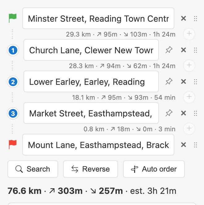
Every leg carries its own figures
- Each gap in the list shows that leg's distance, climbing and time, so you see how the day divides, not just the total.
- The + between two rows adds a stop on that leg. Drag a row by its handle to reorder, or type a place name into any box.
- Reverse routes the way back afresh: one-way streets and turn restrictions mean it is often not the way out.
Open the planner and try it Every setting, in the help Watch: your first route, start to finish
2 Our own engine
Routes are worked out on two routing servers of our own, each with the whole planet's map. If one is busy or down, the other answers; only if both are out does the planner fall back to the public BRouter service. Nothing you plan is sent to a third party while ours are up.
Road names, surfaces and one-way warnings come from our own copy of OpenStreetMap too, the same one that finds the cafes, water and campsites along the way: one map for both.
3 A profile for each way of travelling
The profile decides what counts as a good road. A road bike, a loaded tourer and a walker get different answers for the same two points, because each profile changes which ways are usable and what each one costs.
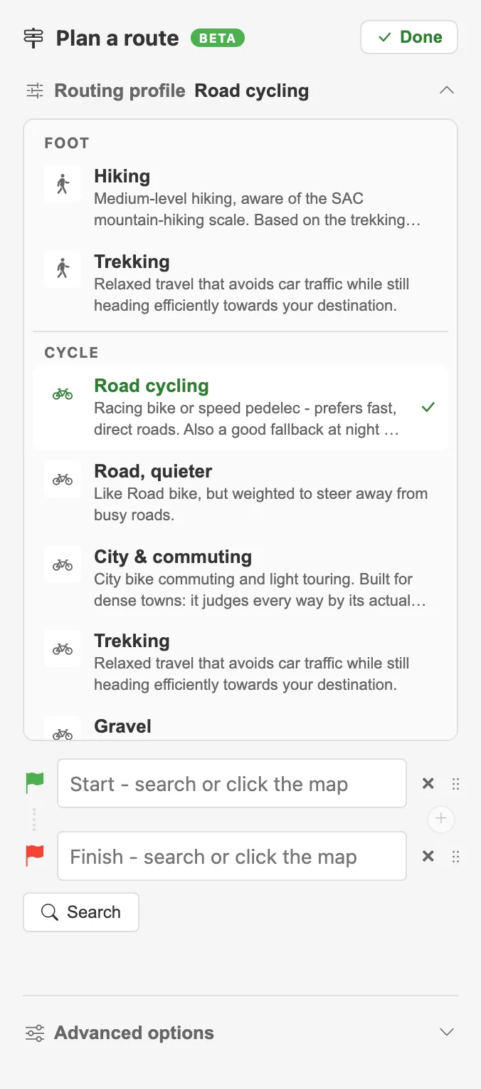
One menu, grouped by how you travel
- Loaded touring is our own profile, for panniers, a trailer, a tandem or a cargo bike. Where Trekking goes straight through stiles, kissing gates and cycle chicanes, it goes round them if there is a sensible way: on a test along the Kenilworth Greenway it avoided three cycle barriers for an extra 225 m.
- City and commuting judges each road and path by what it is actually made of, surface and smoothness, not by its label, and will take a rougher way to get you off a busy one.
- Gravel can go looking for tracks: with Prefer unpaved tracks a Yorkshire Dales test route came down from 21.1 km to 17.4 km, cutting straight across where the road goes round.
- Boat and Paddle (in beta) keep to canals and rivers, through locks, and treat a weir as a carry.
4 Flatter or hillier
Keswick to Ambleside in the Lake District, on the road bike profile, asked three ways:
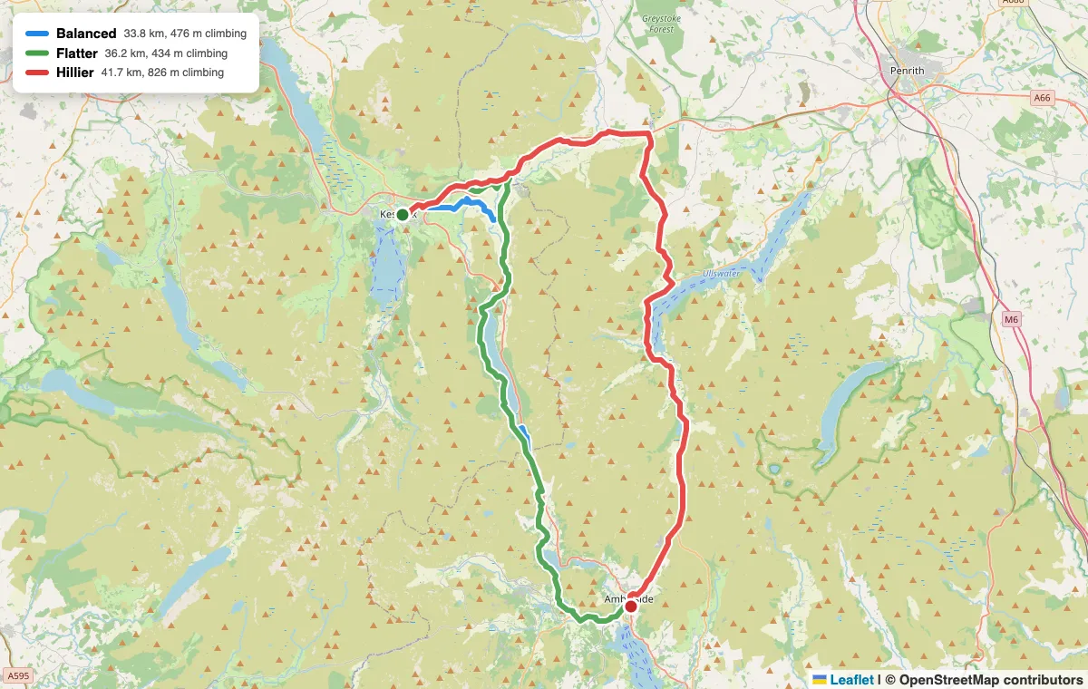
Balanced 33.8 km and 476 m of climbing; Flatter 36.2 km and 434 m; Hillier 41.7 km and 826 m
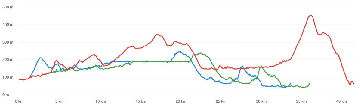
The same three routes as elevation profiles: blue Balanced, green Flatter, red Hillier over Kirkstone Pass
Open in PitStopper: Balanced Flatter Hillier
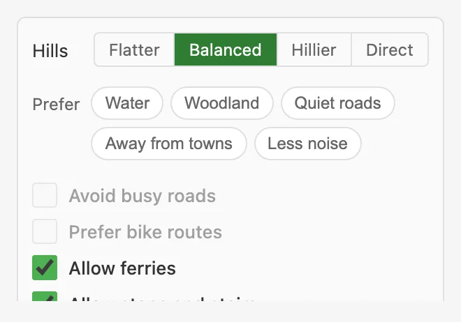
Flatter makes climbing expensive, so it will add some distance to save a hill. Hillier is not its opposite: nothing in a router can reward climbing, so it raises how much climbing comes free, and the route stops flinching from the high road. Here that is Kirkstone Pass. Direct ignores height altogether and takes the short line. The planner only offers the settings your profile can act on, and greys out the rest with the reason.
Advanced options
These live under Advanced options, with the scenery settings below and a handful of tickboxes. They nudge the profile rather than replace it; hover any of them to see what it does. Turn-by-turn is switched on here too.
5 Along water, away from traffic
Utrecht to Breukelen in the Netherlands, on Trekking. The usual answer runs beside the railway; with Prefer water it follows the Vecht through Oud Zuilen and Maarssen, for 1.4 km more.
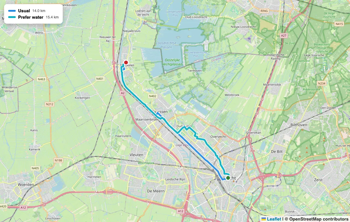
Usual 14.0 km; Prefer water 15.4 km along the river
Open in PitStopper: Usual Prefer water
Alongside it: Woodland, Quiet roads (estimated traffic), Away from towns and Less noise. They combine, and they cost distance, as they should: on Reading to Henley, following the Thames added about a fifth.
6 Options, not one answer
For the same points the planner offers up to three routes, each drawn in its own colour. Freiburg to Titisee in the Black Forest, on Trekking:
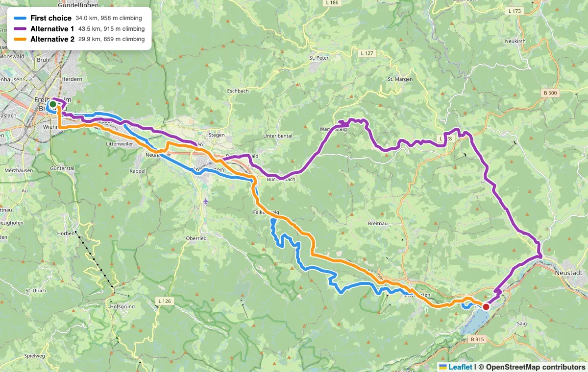
The first choice 34.0 km and 958 m of climbing; Alternative 1 43.5 km and 915 m; Alternative 2 29.9 km and 659 m
Open in PitStopper: Freiburg to Titisee, with its alternatives
The first choice is the one the profile rates best, not the shortest. Alternative 2 is 4 km shorter with 300 m less climbing, because it takes the main valley road up the Höllental; the first choice climbs through quiet forest roads instead. Which is better is yours to decide, so Compare routes puts them side by side on one elevation chart and marks the shortest, the quickest and the one that climbs least.
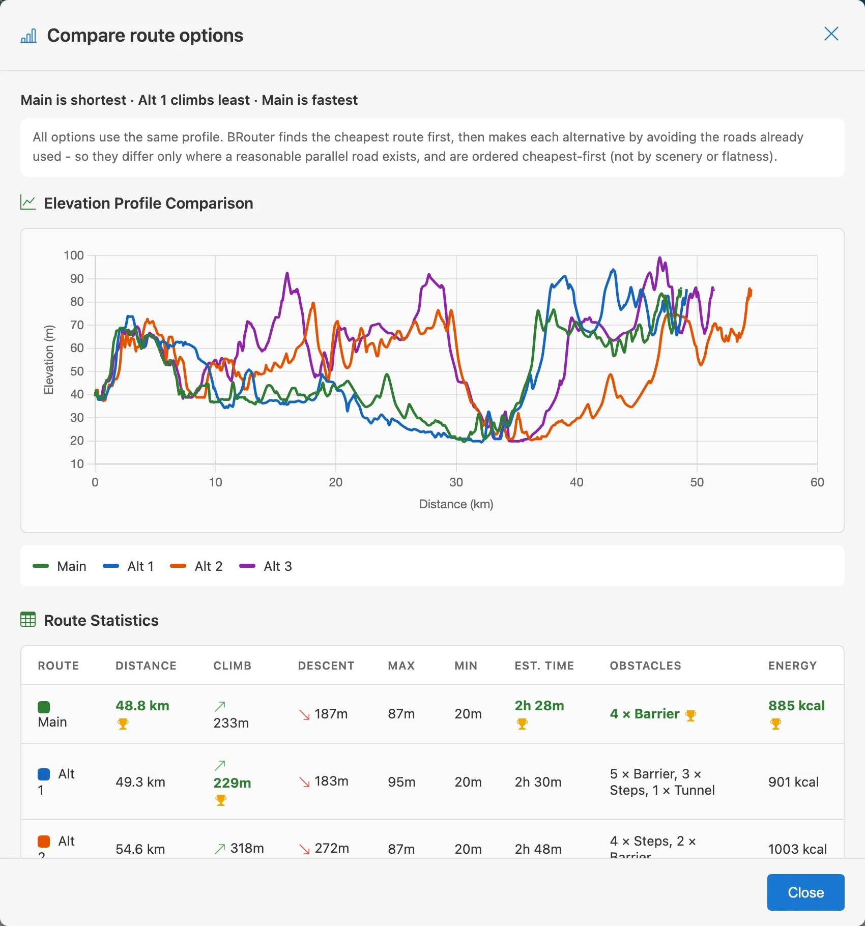
Compare routes: the trade-offs in one table
7 Round trips
Ask for a loop of roughly the distance you fancy, from 5 to 300 km, and the planner builds several from your start, heading off in different directions and at slightly different lengths, each labelled with what it really came out at. Add a second point, a cafe or a col, and every loop is built to pass it.
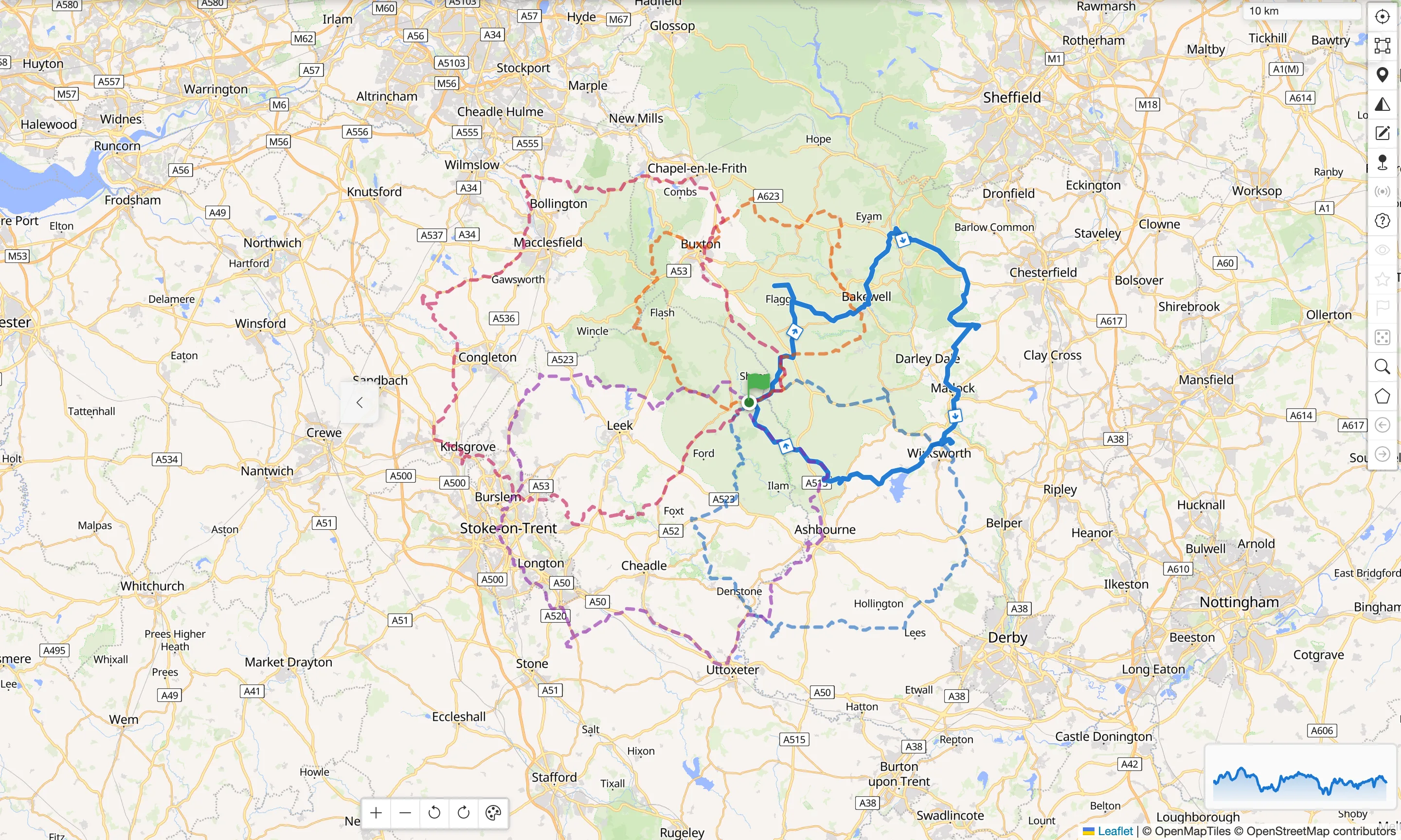
100 km loops from one Peak District campsite: same start, genuinely different rides
8 The best order for your stops
The order you placed your stops in is rarely the order worth riding. Auto order works it out, measuring the legs that matter as real routes on our servers, because a straight line is wrong exactly where a river, a motorway or a ridge forces a detour. A nine-stop plan takes around thirty measurements rather than fifty-five.
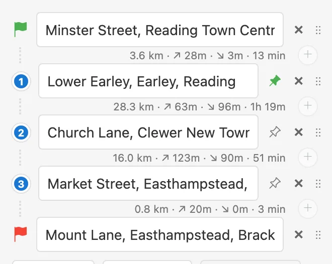
A day out from Bruges in Belgium, five villages added in no particular order, and the answer Auto order gave:
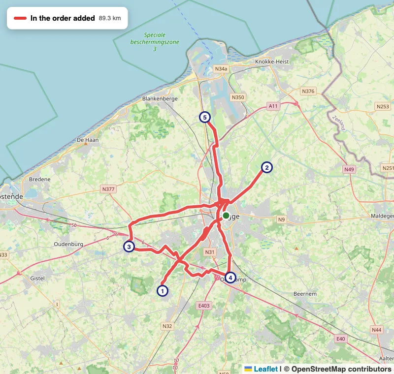
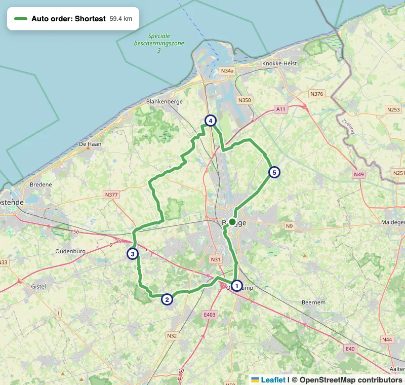
Open in PitStopper, then press Auto order: Bruges, five villages
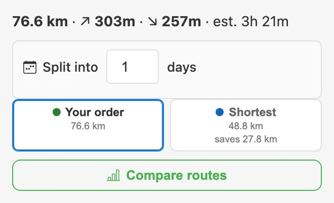
Nothing moves until you choose: the answers arrive as options beside your own order, Shortest, Quickest or Least climbing where they differ, each saying what it saves. Pin a stop and the rest order round it: the pub last, the ferry in the middle.
9 One section differently, places avoided
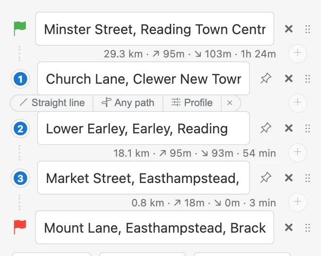
One stretch can follow other rules than the rest: a straight line across a beach or open moor, any path where a mapped way exists but your profile refuses it, or a different profile, gravel through the forest section of a road ride. Hover the gap between two stops for its menu.
One section, its own rules
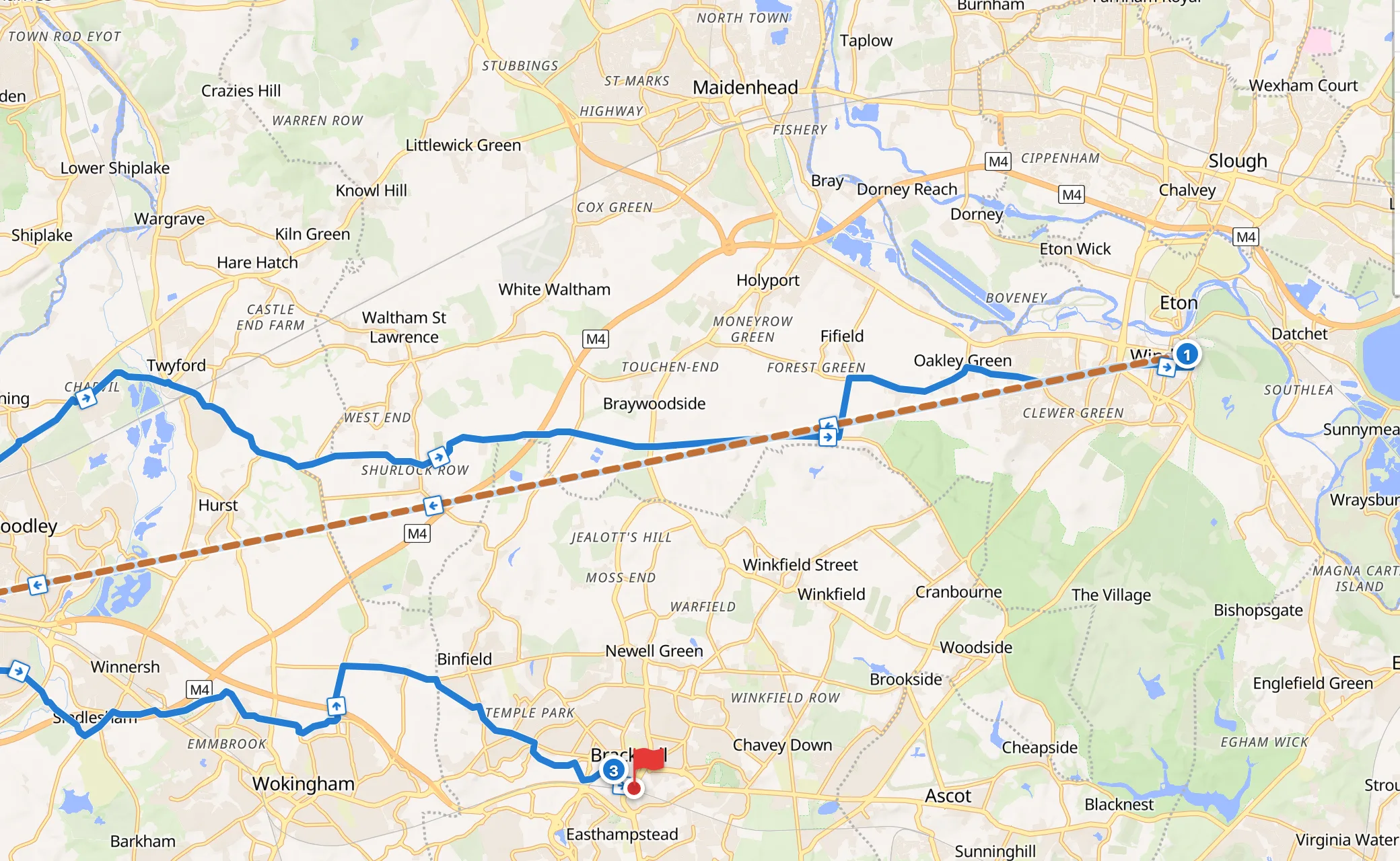
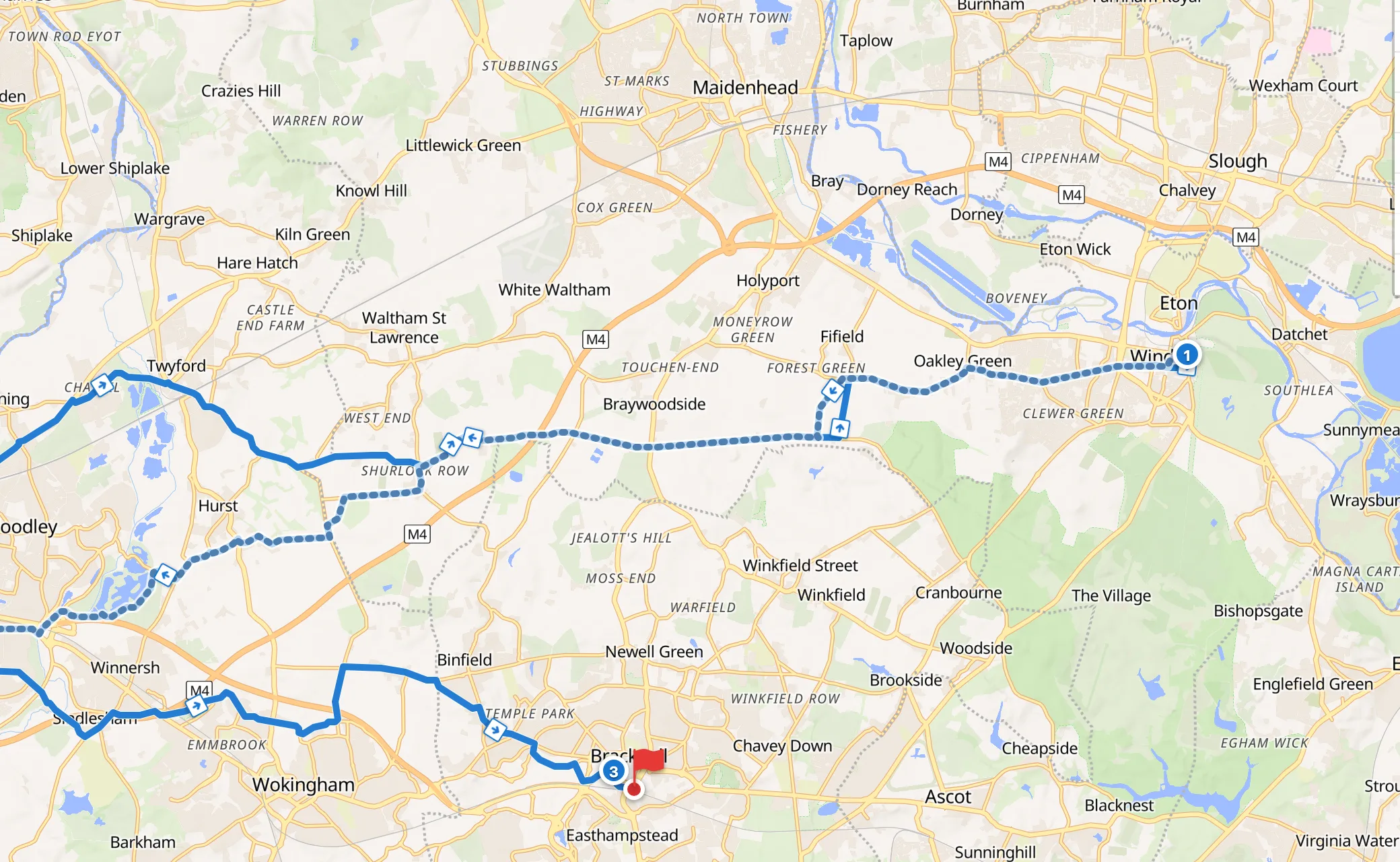
A section like this belongs to its place in the list, not to a place on the map, so Auto order will not reorder a plan that has one.
Right-click a junction you know is horrible and choose Avoid this point, or draw round a closed park or a market-day town centre. The route goes round whenever there is any way round, even a long one; where there is none, the only bridge, it goes through and says so rather than failing.
10 Turns with road names
A planned route carries turn-by-turn instructions that Cruiser and Locus Map speak aloud, each naming the road you turn onto: "Turn left onto Stadium Way", not just "Turn left". The names come from our own copy of OpenStreetMap. A road with no name gets a plain "Turn left", never the name of the road beside it: a confident wrong street name is worse than none.
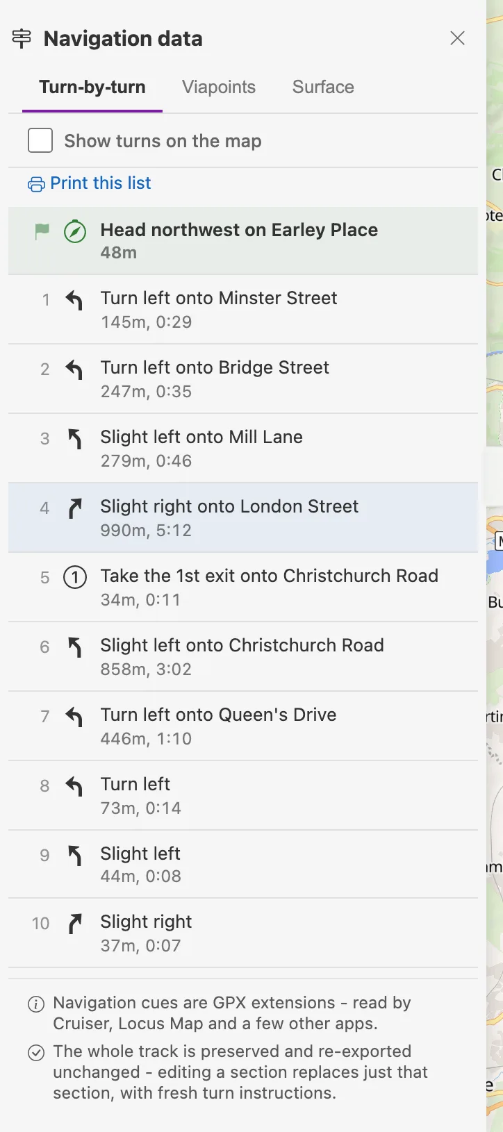
Every turn names its road, where the road has a name
The list is under Tools → Navigation data and prints as a roadbook. Show turns on the map puts each one where it happens.
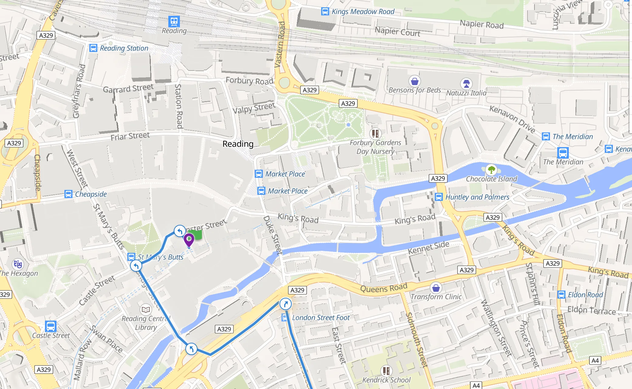
The same turns, on the map
Which bends get an instruction, and which don't, is written down with diagrams on How turn-by-turn instructions are made.
11 Press Done
Done routing, discover POIs turns the plan into a route like any other: the elevation profile fills in, and PitStopper finds the water, cafes, shelter and fuel along it. It exports as GPX or FIT with the turns, your named stops and the places you starred.
- Plan next day carries on from where this route finishes, for a tour planned a day at a time.
- Split into days cuts one long route into daily stages, each with its own distance and climbing.
12 Try it
Every setting and what it does: Route Planning in the help. Finding what is along a route you already have: the quick start guide.