Planning a route, not just following one
PitStopper started as a way to find what is along a route you already had. It also draws routes: open the Plan tab, click a start and a finish, and it works out the way between them. This guide is about that half, and about the three things it does that most planners do not: route one section differently from the rest, write turn-by-turn instructions a navigation app will speak aloud, and work out the best order to visit your stops.
Everything here is drawn with our own routing servers, using OpenStreetMap data. Nothing is sent to a third party while you plan.
1 Start, finish, stops
Click the map for a start, then a finish. Type a place name into a box instead if you would rather, or press Search. The route appears as you go.
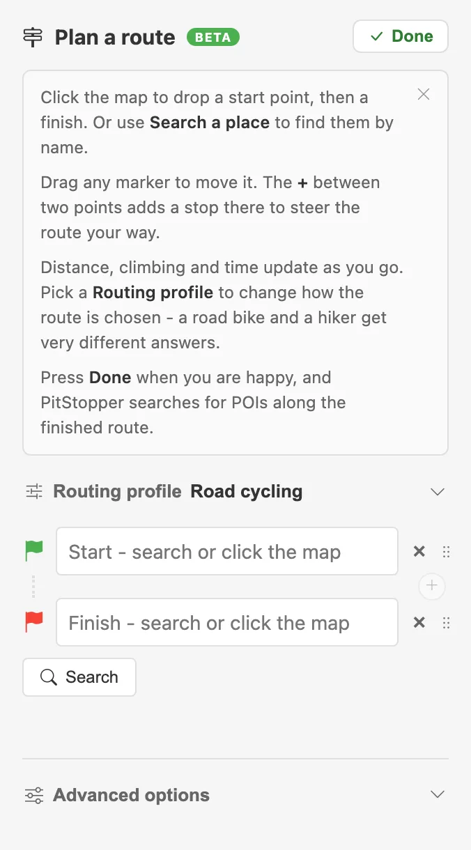
The planner, before anything is placed
Add stops in between and the plan grows a row each. The + between two rows inserts a stop on that leg rather than at the end of the list, which is what you want when the route is nearly right and one section is wrong. Each gap shows that section's own distance, climbing and time, so you can see how the day divides rather than only the total.
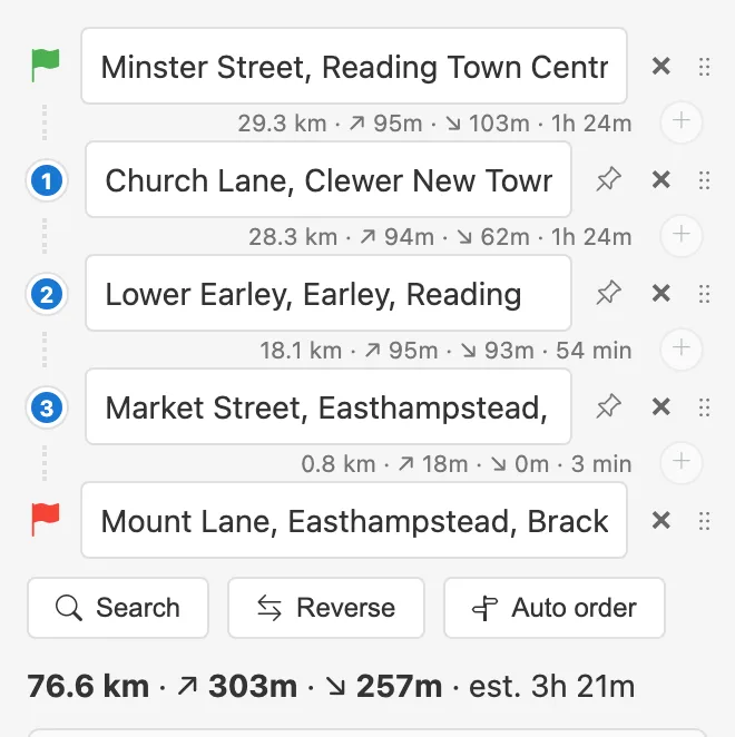
Every leg carries its own figures
Drag a row by its handle to reorder it, drag a marker on the map to move it, and press Reverse to swap the ends. Reverse re-routes rather than drawing the same line backwards, because one-way streets and turn restrictions mean the way back is often not the way out.
2 Routing profiles
The profile decides what counts as a good road. A road bike and a hiker get very different answers for the same two points, and the difference is not a preference setting bolted on afterwards: it changes which ways are usable at all.
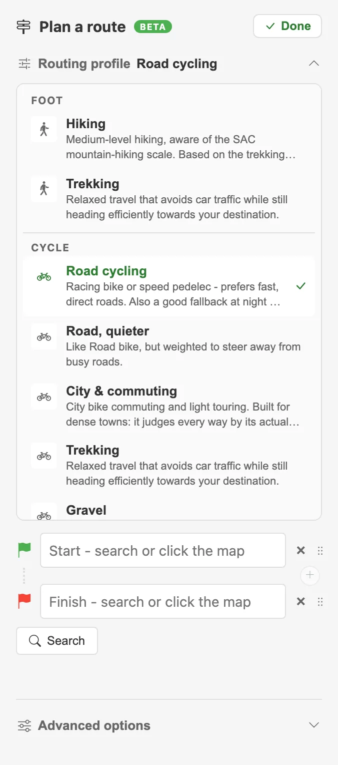
Pick the activity first, then the profile within it
Cycling alone has several: Road cycling sticks to tarmac and keeps the pace up, Quiet roads trades directness for less traffic, Gravel and Mountain bike will take tracks that a road profile refuses, and Trekking sits in the middle. Walking, motorbike and car are there too, each with their own set.
3 Hills, surfaces and the roads you want
Under Advanced options the profile can be nudged without being replaced: prefer flatter ground, avoid busy roads, prefer paved, avoid steps or fords, and so on. Each applies where the chosen profile supports it, which is why they are nudges rather than switches.
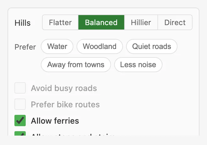
Advanced options, including the turn-by-turn setting
This is also where Turn-by-turn lives, which is section 7, and where a rider profile (your weight, the bike, your fitness) can sharpen the time estimate for hilly routes.
4 Routing one section differently
Sometimes one part of a route is not a routing problem. A ferry, a path that exists but is not mapped, a private road you have permission to use, a beach. Every leg has its own small menu for exactly that: hover the gap between two stops and it appears.
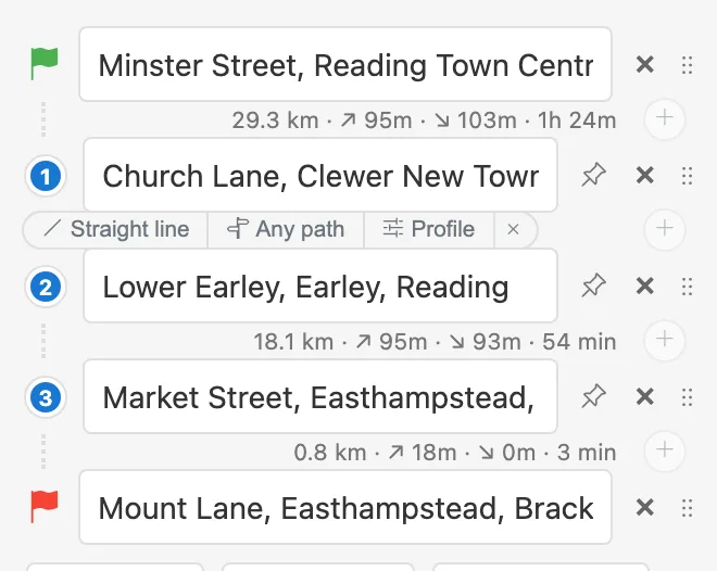
Each leg can be routed on its own terms
Straight line joins the two stops directly, ignoring the road network entirely. The map draws it as an orange dashed line so it is never mistaken for a road you can ride.
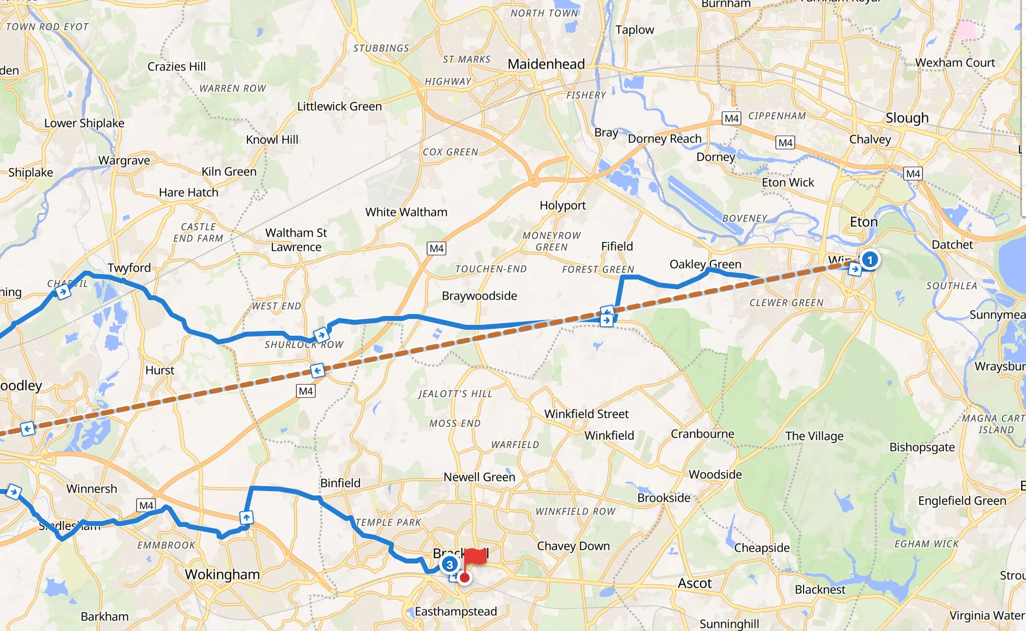
A straight-line section, drawn so it cannot be mistaken for a road
Any path still routes, but over anything that exists rather than only what your profile allows. It is the middle ground for the ferry terminal, the access track or the footbridge that a road profile will not touch. It draws as a blue dotted line.
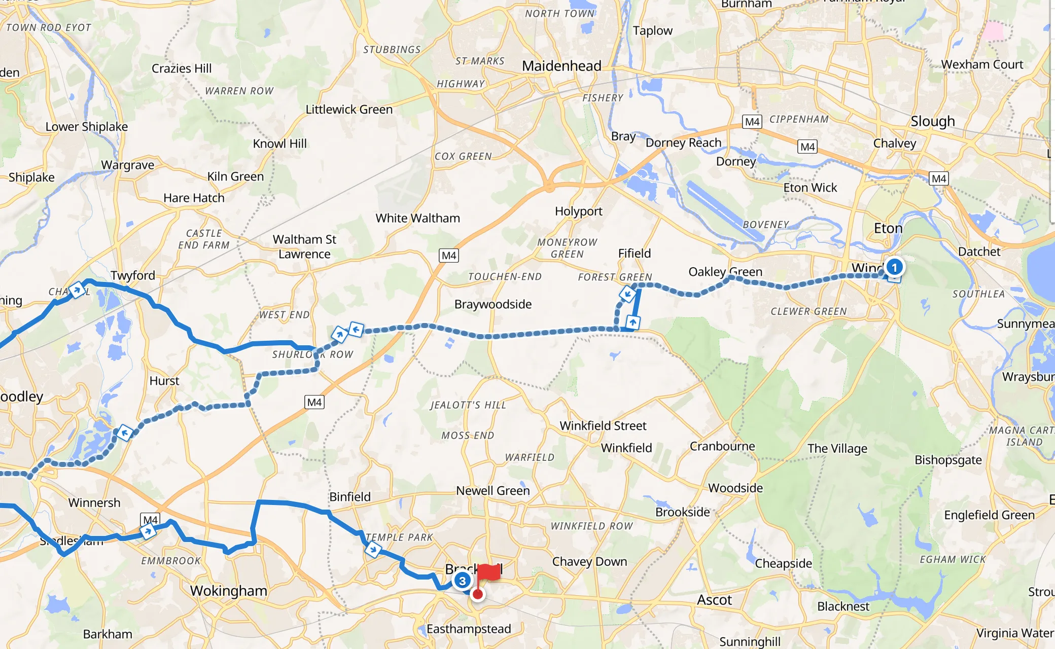
Any path: still a route, but not restricted to your profile
Profile gives that one leg a different profile altogether: gravel for the off-road section of an otherwise tarmac ride, or walking for the bit where you push. The rest of the route keeps the profile you chose.
These belong to a position in the list, not to a place. That is why Auto order refuses to run while one is set: reordering the stops would move your straight line onto a leg you never chose.
5 Auto order
Put four stops on a map and the order you typed them in is rarely the order worth riding. Auto order, beside Search and Reverse, works out the cheapest order to visit them in. The start and the finish stay where they are; only the stops between them move. Start and finish in the same place is a loop, and it handles that too.
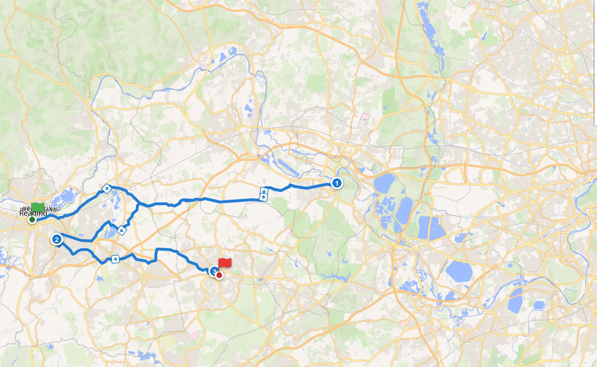
Four stops in the order they were typed, on the ground: 76.6 km of doubling back
It works in two passes. Straight-line distances are free, so they go first and decide which legs are worth measuring; then those legs are measured as real routes on our own servers, and the answer is worked out again. Real routes matter because the straight-line answer is wrong exactly where a river, a motorway or a ridge forces a detour, which is when you wanted the help. A nine-stop plan takes around thirty measurements rather than the fifty-five that measuring every pair would need, and the button becomes Cancel while it works.
Nothing moves until you say so. The answers arrive as route options beside your own, each saying what it saves.
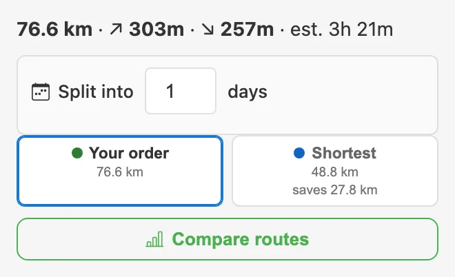
The same four stops, in a better order: 27.8 km shorter
Click the one you want and the list rearranges itself. The options stay on offer, so you can click between them the way you would with alternative routes, and Ctrl+Z (Cmd+Z on a Mac) steps back.
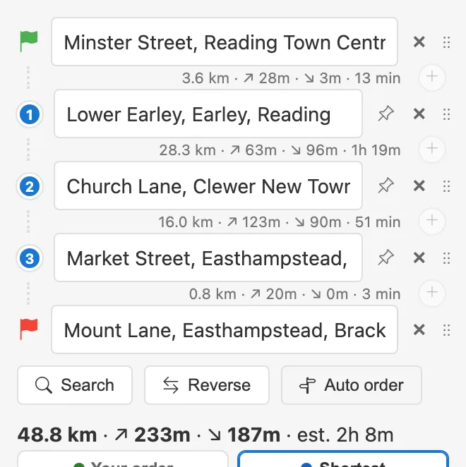
Applied: the same stops, reordered
Where more than one measure picks the same order - shortest, quickest and least climbing often agree - they collapse into one option rather than three identical ones, and the tooltip says which agreed.
Pinning a stop
The pin on a row means leave this one where it is, and everything else orders around it. Useful when the order is nearly free but one thing is fixed: the pub last, the ferry in the middle, lunch in the town with the bakery.
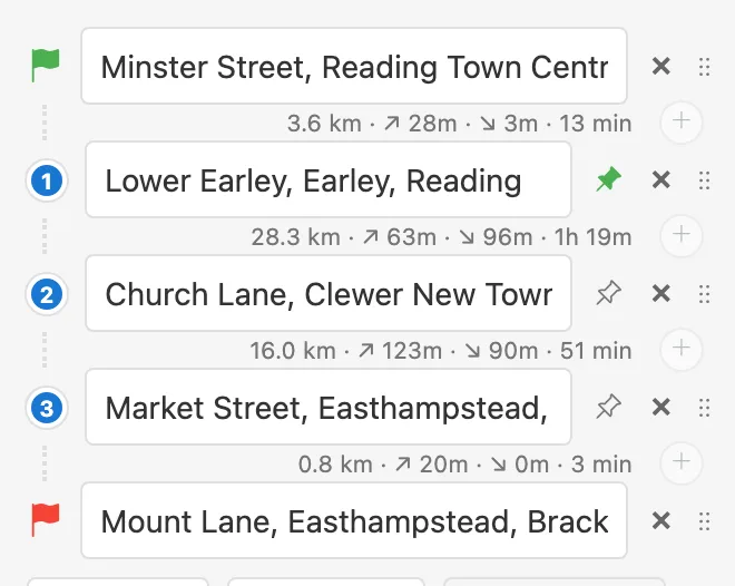
A pinned stop stays where it is
6 Alternatives and compare
For most routes PitStopper also offers a few genuine alternatives: the same profile, re-run while discouraging the roads already used, so they are different ways rather than the same way redrawn. They appear as chips under the figures, and Compare routes puts them side by side.
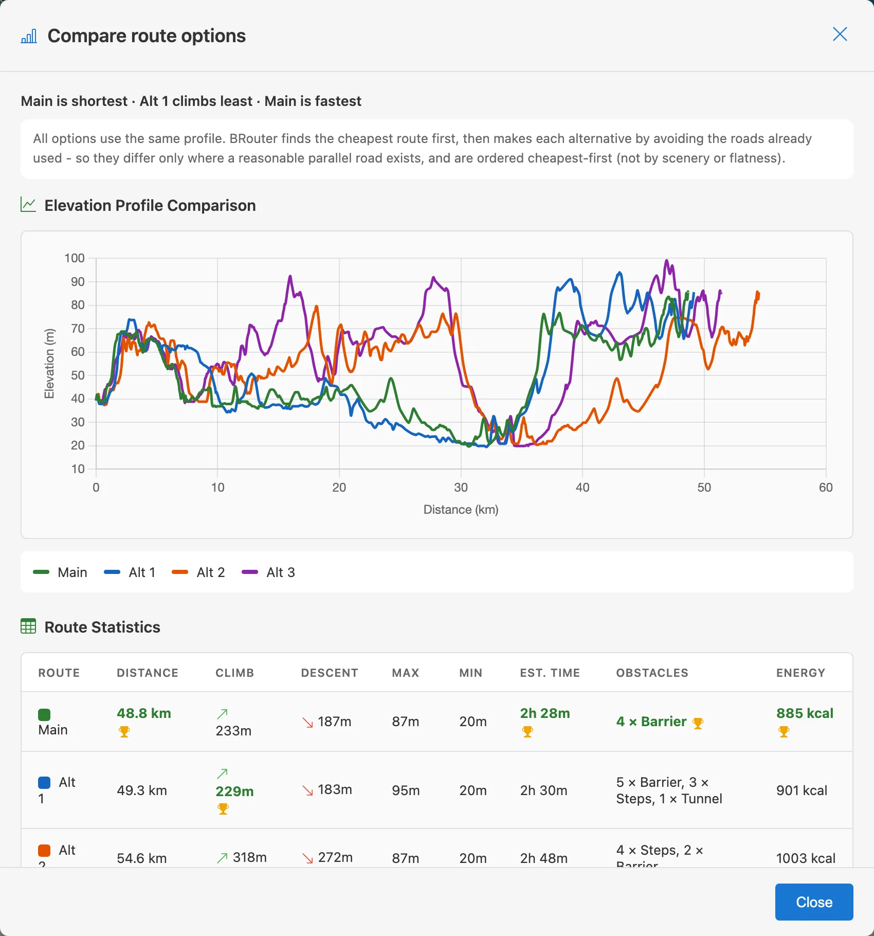
Compare: the options, measured against each other
The comparison shows distance, climbing, descent and estimated time for each, so a route that is 3 km longer but 200 m flatter is an easy call rather than a guess.
7 Turn-by-turn
PitStopper writes navigation instructions into the GPX it exports: turn left, take the second exit, keep right. Apps that read them - Cruiser and Locus Map among them - announce them aloud as you ride. Apps that do not simply ignore them, so the file still works everywhere.
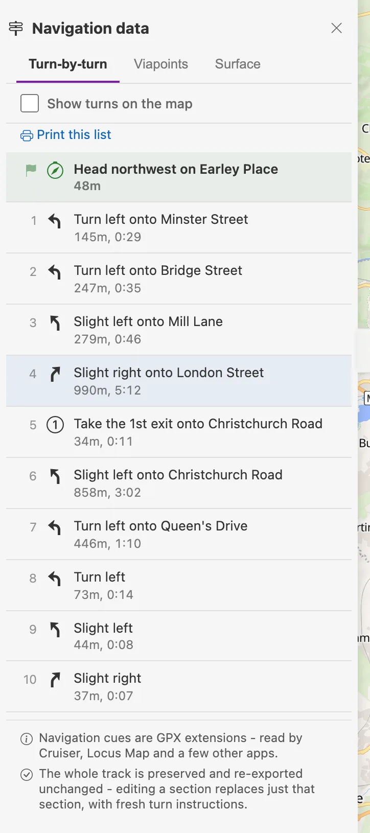
Every turn, with the road it is onto
The list is under Tools → Navigation data once a route has them. It prints, which is the cheapest roadbook there is, and Show turns on the map puts each instruction where it happens.
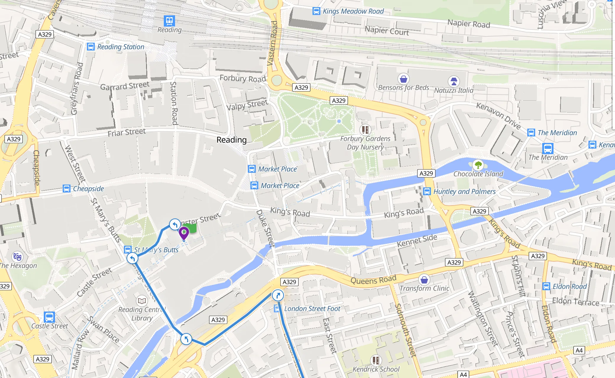
The same turns, on the map
On a route you loaded rather than drew, PitStopper works the turns out from the track itself, naming the roads from OpenStreetMap. Editing one section replaces just that section, and the rest of the track is re-exported byte for byte.
8 Finishing the route
Press Done, discover POIs and the plan becomes a route like any other: the elevation profile fills in, and PitStopper searches for what is along it - water, cafes, shelter, fuel, whatever you have ticked. From there it exports as GPX or FIT, with the turn instructions, the stops you named, and the places you starred.
Two things worth knowing at that point:
- Plan next day carries on from where this route finishes, for a tour planned a day at a time.
- Split into days cuts one long plan into daily stages, each with its own distance and climbing.
The full help goes further into each of these, and the quick start guide covers the POI side.